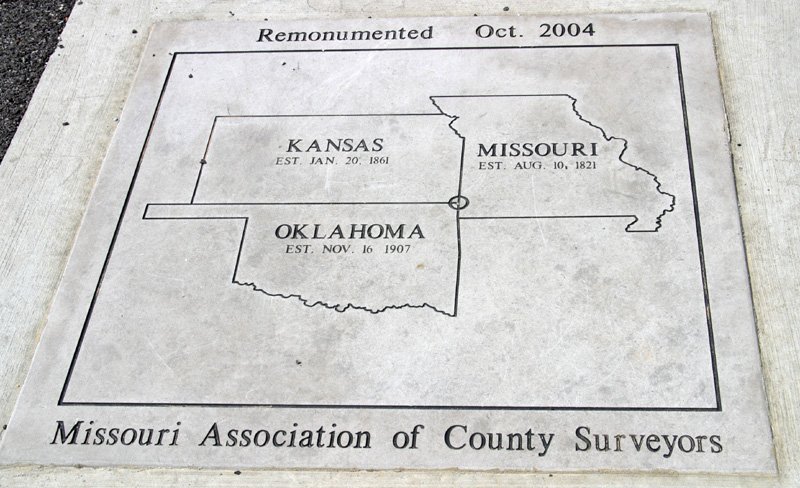
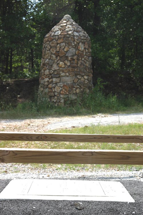
Tri-state markers at the meeting of the Kansas, Oklahoma, and Missouri borders. The original stone monument was built in 1938 by the Youth Work Administration. A new monument was placed in October 2004 and lies several feet east of the old monument.
Location
On US 44 cross Missouri border. Take exit 1 for US-400 W/US-166 W toward Baxter Springs/Kansas. Sharp left at SE 118th St/S 700 Rd/Stateline Rd. **
OpenStreetMap Google Maps
36.998602, -94.618102
36.998602, -94.618102
Photos
Notes
Note:
Marker put up by Missouri Association of County Surveyors, since on border of Oklahoma we included it in our database.
Links:
* GPS coordinates and description from waymarking.com.
** Directions approximated using Google Maps.